On the Road Again…
I woke up August 20, the morning of my departure and lay in bed wondering, “What am I thinking? Two months away from my nice, cozy, happy house? Away from all my friends? Living out of a tiny space? Surrounded by dirt and grime? Spending most days driving all day in strange places I’ve never been? For two whole months? or even more?”
Then I thought about all the preparations I’ve made, and the Lewis and Clark story that is beginning to unfold in front of me, and how much I do love roadtrips of all kinds, even long distance ones. And I realized that not only am I ready for this trip, but this is the culmination of an adventure I’ve been thinking about for over two years, ever since I visited St. Louis and went through the Louis and Clark exhibit in the museum under the famous arch. So what am I worried about? I’ve been waiting for this moment, and it’s finally here! LET’S GO!!!
I’m writing this four days into the trip. I’ve just completed the first leg of the Lewis and Clark expedition, which ended when they arrived near St. Louis. By then it was December, and the party had to find a place to spend the winter. They would not get going again until May 1804.
To get to St. Louis they travelled down the Ohio River from Pittsburgh (starting on August 31) to where it flows into the Mississippi, then up the Mississippi to the confluence with the Missouri. Up to this point they are traveling on charted rivers, visiting existing settlements, exploring land clearly controlled by the new United States of America. Once they left St. Louis that would no longer be the case.
Some impressions so far:
Roadtripping in 1803
Early American explorers had many technical challenges facing them. When I think about it, it’s really incredible what they were able to do with the limitations they had. Some examples:
Getting from Point A to Point B
As Stephen Ambrose put it in Undaunted Courage, “nothing moved faster than the speed of a horse” in 1803. This meant that even the fastest horse would take two to three days to go just 100 miles. There were no actual roads outside of the bigger cities, only trails, and sometimes not even that. Land travel was slow going.
The answer to moving heavy items or large quantities of anything more efficiently than horse and wagon was, of course, water. In 1803 water was the primary method of conducting commerce. Rivers were essential to trade, and Jefferson was interested in figuring out how to harness the rivers to create a navigable water passage to the Pacific.
Of course, even though it was an improvement over horse drawn vehicles, water navigation was no picnic. The steamboat was in the process of being invented, but it was not ready for prime time in 1803. Robert Fulton wouldn’t launch the first steamboat until 1807, after the expedition had already been to the Pacific and back. This meant that to get anywhere they had to use sails or paddles. If the river was too low for the boat to float smoothly, the men had to use poles to push along the bottom of the river and move the boat. Or if it was really low the men got out and dug trenches in the riverbed, then dragged the heavily loaded boats until they floated again. Arduous work.
Their trip down the Ohio River was with the current, which meant they could just float along, but once they hit the Mississippi they turned north and were paddling upstream, against the current that was flowing south. The difficult work of getting the boats from the tip of Illinois up the river to St. Louis, a distance of about 200 river miles, was so challenging and difficult that it became clear the expedition would need many more men if they had any hope of getting all the way across the country.
Once they left St. Louis, their trip up the Missouri would continue to be against the current. This was to be their situation all the way until they crossed the Continental Divide in the mountains, at which point the rivers began flowing toward the ocean. What a relief that must have been!
Communication
There were no telephones. No telegraphs. There was only the mail, and it could take weeks for a letter to reach its destination, and weeks to receive a reply. The courthouse in Cahokia, on the Illinois side of the Mississippi near St. Louis, was the western most post office and a commercial hub. Once the corps started up the Missouri River, it would be difficult to send any letters home or reports back to Jefferson until they returned, whenever that might be.
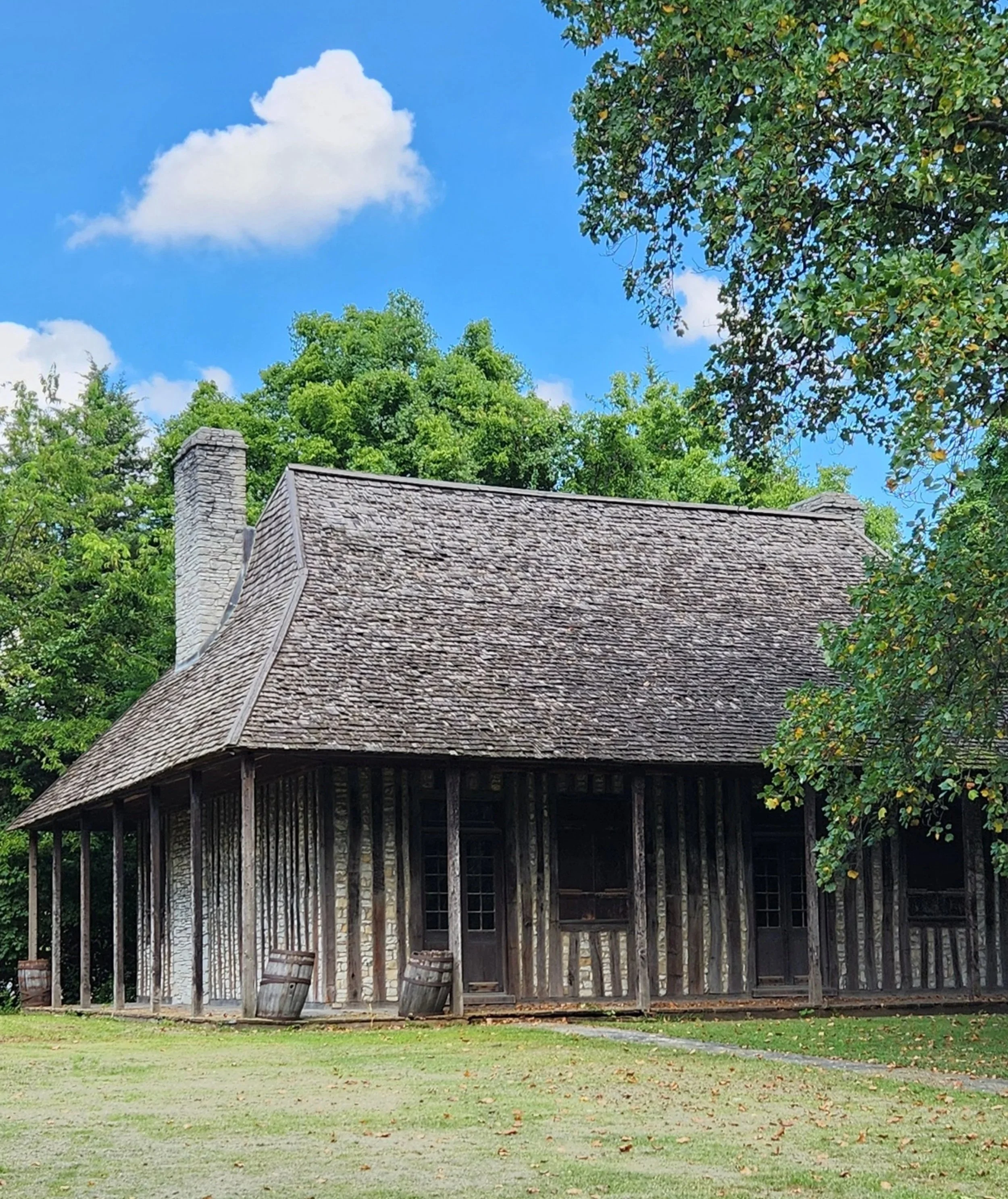
This is the preserved Cahokia courthouse building, all that’s left of a once bustling commercial center for the region.
Louisiana Territory
To fulfill their mission, Lewis and Clark needed to cross through this territory without encumbrance. I reported in my last article that on July 4, 1803 it was announced that Napoleon had sold the entire Louisiana Territory to the United States. What I didn’t mention was that Spain was still in control of the territory when that France-US deal was made. Spain had agreed to transfer its rights to France, but it hadn’t officially happened yet by the time the expedition reached the edge of the American controlled territory. Spain would not allow the expedition to proceed until the transfer to France was complete, at which point France would transfer its rights to the Americans.
The politics and treaties had to play out before Lewis and Clark could launch themselves and all their boats and all their gear and all their supplies plus all their men into the Missouri River and head west. Spending the winter on the Illinois side of the river actually turned out to be a good thing. While the treaties were being signed and delivered to the right people, Lewis and Clark made the most of the extra time they had.
Lewis spent most of the winter in Cahokia and used his time to network and learn what he could about the territory they were about to enter. Jefferson had been salivating at the prospect of sending an expedition into that wilderness, and assumed that it was mostly uncharted. But in fact both Spain and France had been operating there for years. There were established trade networks as well as maps from previous explorers. Lewis was able to consult with these people, learn from them, and adapt his plan to take into account the new information. This generous guidance from those who knew the area well proved invaluable to Lewis’s planning.
When May 1804 rolled around, the expedition was ready to go, with all the negotiations and diplomatic activities completed.
Scope Creep
As noted above, by the time they reached St. Louis, Lewis and Clark knew they needed at least double or even triple the number of men they had, which was nine when they left Louisville. Adding that many more men also meant they were adding significantly to the amount of supplies they were going to need - food, weapons, tools, camping gear, etc. And they would need more boats to carry all the additional supplies. And horses for getting around on land.
During the winter months of 1803/04, Clark stayed mostly at Camp Dubois keeping an eye on the men and training them for the skills they would need when they finally set off in the spring. Lewis spent much of his time at Cahokia, sending and receiving communications from Washington, adjusting his plans based on the new information he was learning, and arranging for the additional supplies they would need.
Roadtripping in 2025
Histories Merging Together
I’m finding it difficult to stay focussed only on Lewis and Clark when I am surrounded by so much history wherever I go. Those two men, by completing this journey, set in motion the full force of the western expansion that occurred throughout the rest of the 19th century. Before the expedition, white settlers west of the Mississippi existed, but were few and far between. After the expedition the floodgates opened and the wild wild west, with all its romance and nostalgia (not to mention all the destruction and decimation) was born. This rapid expansion had disastrous consequences for the indigenous people, and the issue of slavery was front and center and hotly debated whenever a new state was brought into the union. The entire 19th century was a complex mix of political and cultural chaos and strife that played out in different, sometimes catastrophic, ways for certain populations. The success of the Lewis and Clark expedition made all that followed possible, and I would say that the consequences are still playing out today.
As I follow the Lewis and Clark trail I find myself making deliberate choices to include some of the other, later historical events into my sphere of interest and exploration.
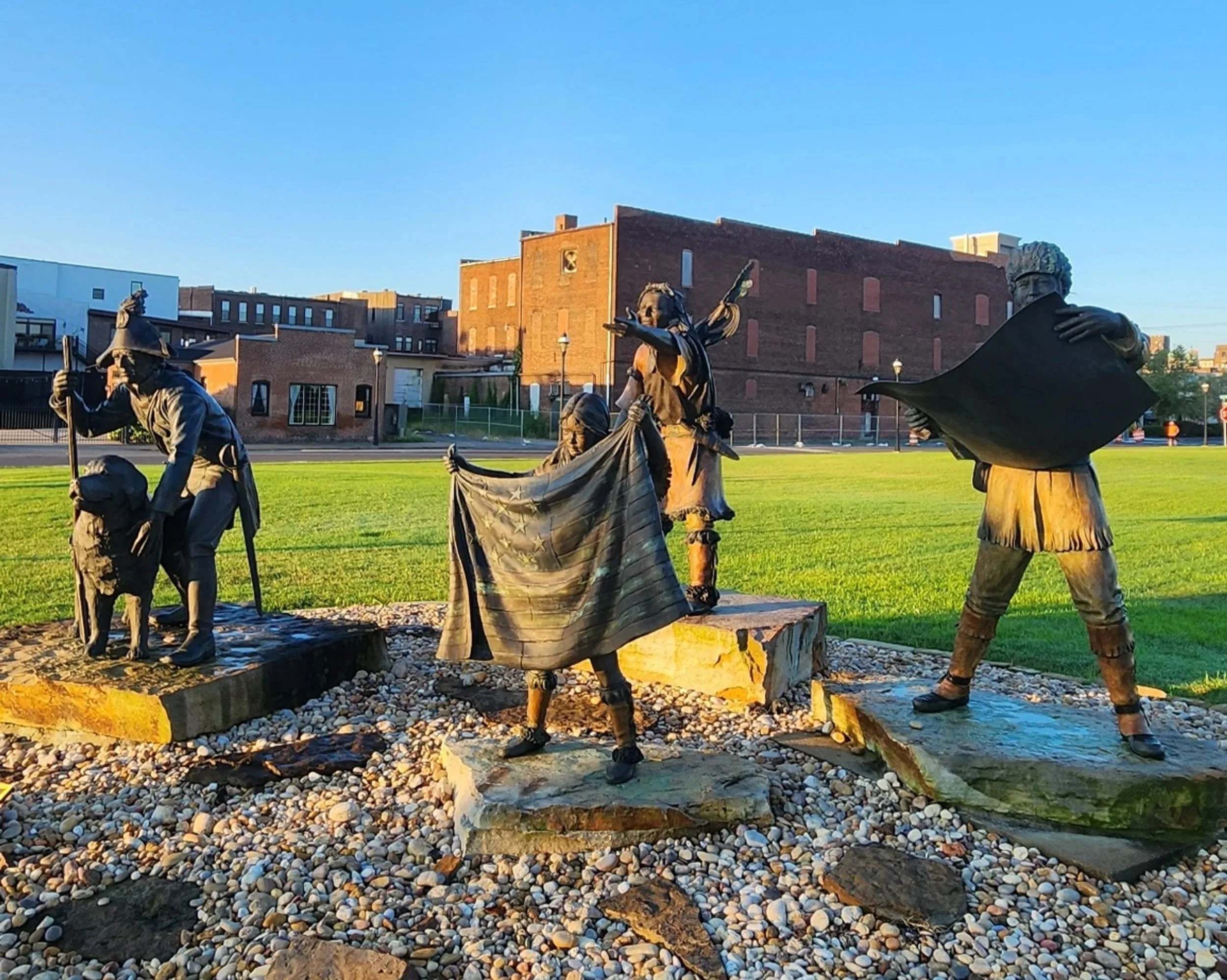
There will be no shortage of statues on this trip.
Too Many Options
I feel a little like a kid in a candy store. Too many interesting sites to see and I can’t make up my mind. Or maybe a better analogy is that of an easily distractible baby or toddler. They are totally focused on one toy until you put another in front of them. Suddenly they forget all about the first toy. Or imagine a dog that is behaving beautifully and walking right at your heel off-leash and you are so proud, until you turn a corner and she sees a chicken on the sidewalk. All bets are off and she forgets everything except chasing and catching and eating that chicken (sorry, Conrad, couldn’t resist…). Yeah, kind of like that.
There just isn’t time for everything! And it’s all interesting!
So I spend each evening looking over my guidebooks with their recommendations, and the history books with their descriptions of the journey, and the maps that show where everything is on my route, then I plot out the next day based on what seems most interesting and also doable. My goal is always to get to my final overnight destination by around 4pm.

This amazing cypress tree is located on former Clark property in Louisville and is several hundred years old. Definitely there in 1803.
Here are some of the highlights from the first four days:
Wednesday, 8/20: Sadie and I stopped briefly at Wapakoneta, Ohio to pay respects to the hometown of Neil Armstrong, who is in some ways the modern day version of Lewis and Clark. It also happens to be where Jay spent his early childhood. I left some ashes at the foot of the Neil Armstrong statue outside the Armstrong Air and Space Museum.
Thursday, 8/21: Spent the morning in Louisville, Kentucky and Clarksville, Indiana. This was where Lewis picked up Clark. Turns out that William Clark, who led the expedition with Lewis, was the younger brother of General George Rogers Clark, eighteen years older and a Revolutionary War hero. The Clark family was large and well-known in that part of Kentucky. In fact, President Jefferson originally tried to recruit George Rogers Clark to lead the expedition years earlier when Lewis was barely twenty and clearly not ready. That journey never materialized and George Rogers Clark refused the offer, having no desire to take on the hardships of such an expedition after all he had already accomplished as a war hero and general. I’m seeing many references to George Rogers Clark as I travel around Kentucky and Missouri.
Thursday, 8/21: Visited the Bluegrass Hall of Fame and Museum in Owensboro, Kentucky. How could I pass up an opportunity like that?? Owensboro sits right on the Ohio River and is a very vibrant, cute town with a great riverfront. Highly recommend a visit.
Friday, 8/22: Fort Massac, outside of Paducah, Kentucky (also a very sweet town and home to the National Quilt Museum). This was significant because it was here that they recruited George Drouillard, a French Canadian who was raised by a native mother and could, therefore, speak several Indian languages, as well as understand Indian cultures. He became an indespensible interpreter for the trip.
Friday, 8/22: Confluence of the Ohio and Mississippi Rivers. This was near the town of Cairo, Illinois, and is the southern most tip of that state. As a town Cairo has definitely seen better days, and I’m pretty sure there were more abandoned and destroyed and falling down empty buildings than intact ones the day I drove through. That being the case, imagine my surprise when I passed a sign advertising the smooth jazz festival this coming weekend on the Cairo airport grounds. Cairo has an airport? Go figure!
Friday, 8/22: Jonesboro, Illinois. This was the site for one of the seven famous Lincoln-Douglas debates in 1858. I had not known or had forgotten that these debates were held while the two men were running for the Senate, and Douglas ended up winning that Senate seat. I guess the publicity of the debates set the stage for Lincoln’s presidential run. Jay was a member of his debate team in high school and was gifted with his use of language. I thought it suitable that I sprinkle some ashes on the site where Lincoln and Douglas stood, so I did.
Friday, 8/22: Cahokia Courthouse. As I said above, this was interesting to me because it was the westernmost post office in 1803. My visit here reminded me of how the passage of time pushes significant landmarks into obscurity. This little site, while preserved, sits in a location that almost no one would stumble upon unless you were looking for it, as I was. The courthouse building looked like it had not been open for some time, but I could see in the windows what looked like a fully intact museum. There was a second building that was the tourist office, which said on the door that they were closed on Thursdays. Great! I thought to myself. This is Friday, so no problem, right? Wrong! The door handles were covered in cobwebs, a clear sign that no one had been here in quite awhile. The historical marker outside that told the story about the courthouse was dirty and smudged; clearly no one is currently taking care of the site. It made me very sad.
Friday, 8/22: Camp Dubois. This was the approximate location up the Wood River where Lewis and Clark’s men and supplies and boats spent the winter. The entrance to the river is directly opposite the mouth of the Missouri, where they would be headed come spring.
Saturday, 8/23: Bellfontaine Cemetery, St. Louis. This is where William Clark is buried, along with many of his children and descendents. I noticed that he named one of his sons Meriwether Lewis Clark, which I found kind of touching, a nod to a deep, deep friendship.
Saturday, 8/23: Visit to Aunt Toosie and her daughter Kim, Marthasville, Missouri (which is right on the Lewis and Clark trail). Aunt Toosie is Jay’s aunt, in her mid-nineties and has always been one of the most active and interesting women I know. She was downhill skiing well into her eighties (and only stopped after she had a skiing accident and lost an eye), and when I saw her she had just recently returned from a week long music camp in Plymouth, Massachusetts that she has been attending annually for many years. We spent so much time catching up that I totally forgot to take the selfie I had intended. Darn!! Oh well, next time.
Next Steps
While I’m driving I have lots of time to think about how to unfold this story I am living out, but less time to actually write it up. So it’s anybody’s guess when the next installment will drop. The weather these first few days has been beastly hot, to the point that Sadie and I bailed out and got a hotel room so we could bask in air conditioning for a night and I could shower and scrape off all the dried sweat and stickiness of the last few days. I’m ready for cooler weather and forgot how hot late August can be!
Til next time,
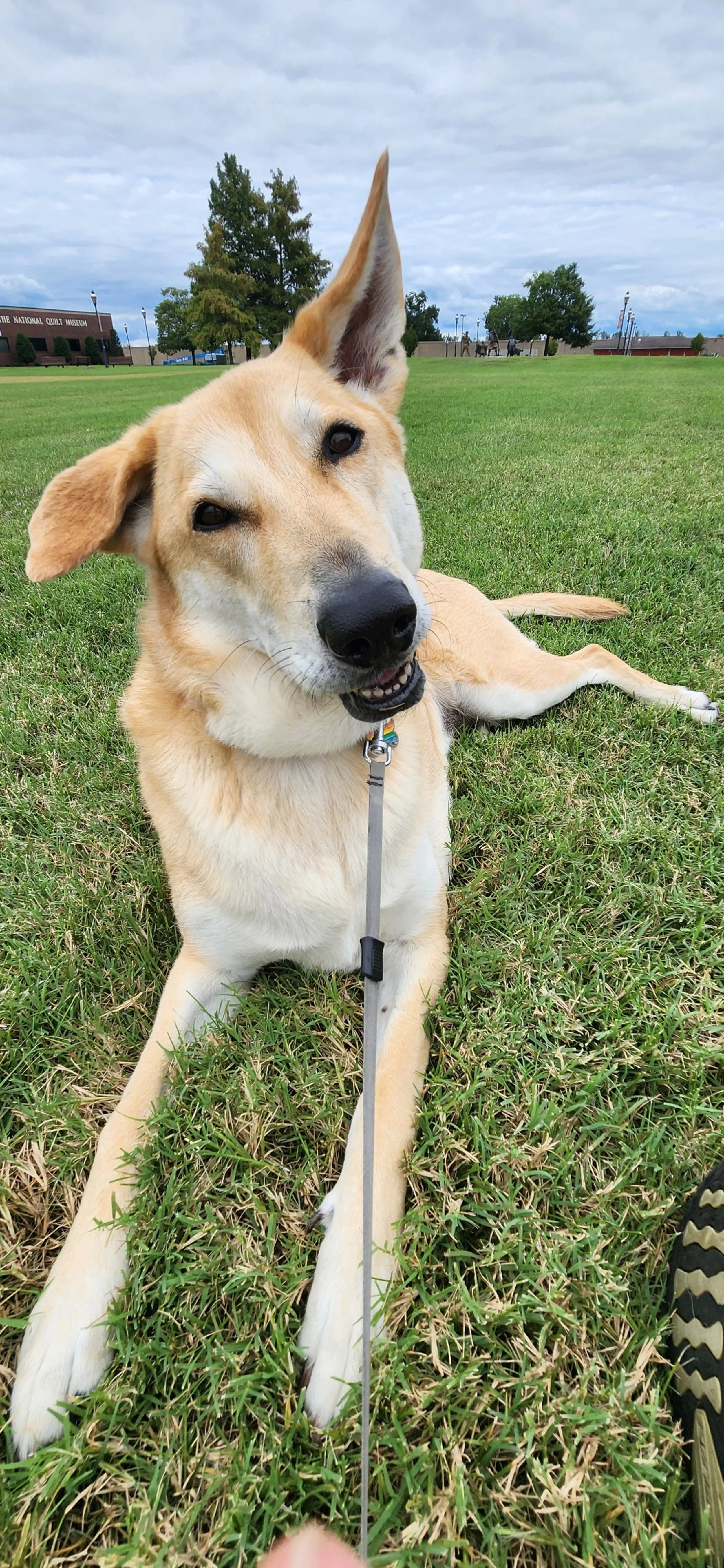
Sadie is managing being cooped up in the van for hours at a time, but really loves it when she can be outside on grass. Bonus if there is water involved!
We are finding our rhythm to make sure we are good travel buddies and both of us are having a good time on this trip.